A winter storm is setting its sights on the Midwest, and some parts of Illinois and northwest Indiana could potentially see a foot or more of snow before the storm clears out of the area later this week.
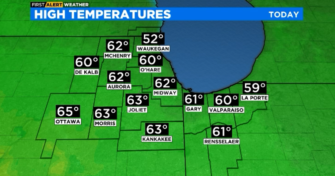
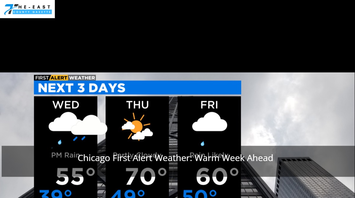
Things will start out unseasonably warm in the Chicago-area on Tuesday, with temperatures rising into the low-to-mid 40s across the region around the noon hour.
That’s when the weather system is going to arrive, bringing showers to the area in the early afternoon.
Those showers are expected to continue until the air temperature causes the precipitation to switch from rain to snow, and from there, intense snow is expected to begin falling Tuesday night and into Wednesday morning.
Kankakee County, along with Lake, Porter, LaPorte, Newton and Jasper counties in Indiana, will be under a winter storm warning around the time that transition to snow occurs, and by Wednesday afternoon it is possible that those areas could see between 6-to-12 inches of snow accumulation.
The heaviest snowfall will likely occur on Wednesday morning, with a snowfall rate between 0.5-and-1 inch per hour falling during that time. That will likely cause serious travel issues throughout the region, according to forecast models, and residents are urged to postpone unnecessary travel.
Another system could follow closely behind the initial system Wednesday and into Thursday, and if it does, another 3-to-6 inches of snow could fall in the areas currently under a winter storm warning, meaning that in all residents could see up to 18 inches of accumulation in less than 48 hours.
For Chicago and surrounding suburbs, the more intense snow accumulations from the storm are likely to remain to the south, but another threat could emerge Wednesday afternoon, as lake-effect snow is possible. If those snow bands develop, then it could combine with the arriving weather system to drive accumulations upward in the area, and could lead to additional advisories or warnings from the National Weather Service.
The snow is expected to clear out of the area by Thursday evening, and behind that storm system colder air is expected to arrive, driving temperatures down into the 20s for the remainder of the work week and into the weekend.