The extent of the snowfall from last week’s storm became visible as the skies over the Mississippi Valley area finally cleared after nine days of overcast conditions.
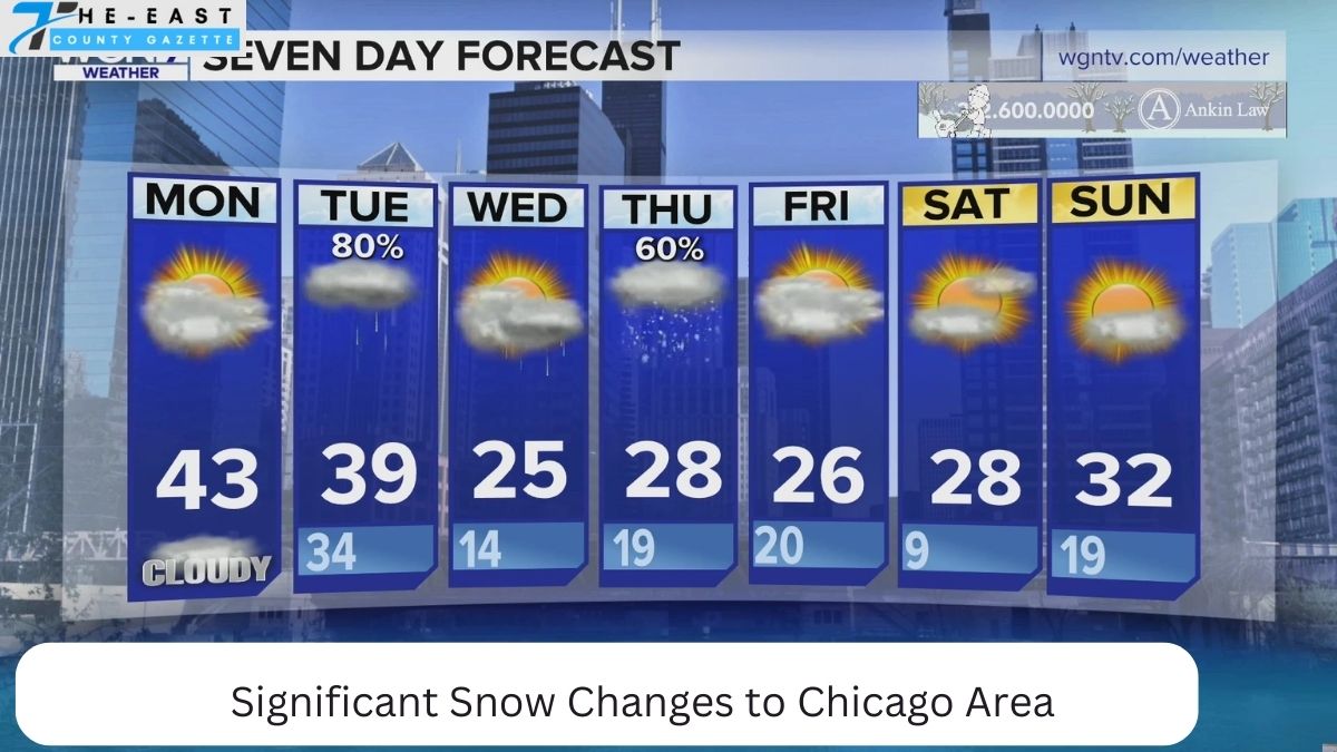
The likelihood of significant snowfall later this week keeps rising.
These numbers indicate a reasonably high chance of heavy snowfall (four inches or more) four days before the event is expected to occur. If the first contour’s probability is greater than 30%, then a significant amount of snowfall over what was predicted is very likely to occur. It is considered highly probable if the probability is higher than 40%. Remember that these odds were well below 20% just two days ago.

A growing number of models are predicting the track of late-week storms.
While there are some discrepancies, the storm center will move east of Chicago late Thursday/early Friday, bringing heavy snowfall to Chicago.
Estimated Amounts of Snowfall
While the GFS model from the National Weather Service is more optimistic about the potential snowfall amounts, most models agree that Chicago could be in for a significant late-week snowfall.

Schedule of possible snowfall
The models agree on a possible snowfall timeline for later this week. Even though the GFS model gives more generous totals, the times provided here align with other forecasts. While snow showers are possible as early as Thursday morning, the bulk of the precipitation is expected to fall on Thursday night and Friday.